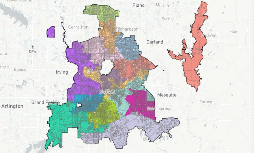
Council members waited for the last opportunity to make their final redistricting map decision. This was the third time this month city officials met to discuss updating district boundary lines. A new map was unanimously approved Monday.
“Redistricting is critical to a functioning representative democracy. I am grateful for the work of our Redistricting Commission, skillfully and fairly led by Chairman Jesse Oliver, and I am pleased that the Dallas City Council was able to coalesce around further modifications to the new map,” Dallas Mayor Eric Johnson said in a press release.
Johnson, who announced last week he had COVID-19, was absent for the vote.

Black and Latino residents said they were worried that proposed redistricting maps being considered by the council would dilute their voting power, break up neighborhoods and diminish cultural and historical ties.
“We do not want to be in a situation to where everything you worked for, everything that you know, gets whitewashed,” Dallas resident Jonathan Maples told KERA in May.
Maples, who lives in the historically Black neighborhood Elm Thicket NorthPark worried that certain district boundaries proposed during the process would have cut through his neighborhood.
The version of the map adopted by the council mostly keeps districts the same.
City district maps are updated typically after each Census. The goal is to rebalance the number of residents in each district to ensure fair representation.
Latest Census results show that the City of Dallas grew by 106,563 residents and now totals about 1.3 million. Demographics remained about the same. Latinos represent 42% of the population, white residents 28%, Black residents 23%, and Asians 4%. Native and Pacific Islanders each represented less than 1% each of Dallas’ population.
The new district plan will be implemented by the next City Council election in May 2023, when all 14 city council seats and the mayor’s office will be up for grabs.
Got a tip? Email Alejandra Martinez at amartinez@kera.org. You can follow Alejandra on Twitter @alereports.
KERA News is made possible through the generosity of our members. If you find this reporting valuable, consider making a tax-deductible gift today. Thank you.


